
- Main page
- News
EASTERN RIVER: RIDDER FIRE SCIENTISTS DO SPACE ANALYSIS
5/28/2021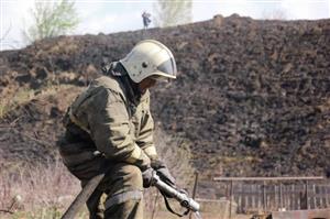
Fires, floods, and earthquakes are catastrophic events. A forest fire near the town of Ridder also shook the country. While the relevant authorities were determining the cause of the silent enemy, our scientists analyzed the consequences with the help of space technology.
Specialists of the Center for Remote Sensing (ERS) at Al-Farabi Kazakh National University assessed the situation after the accident.
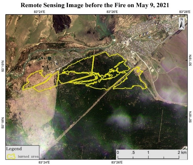
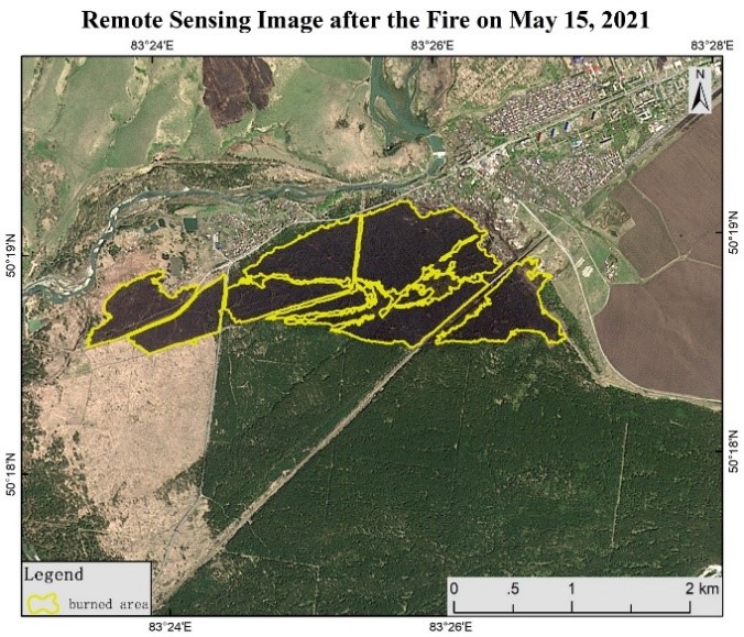
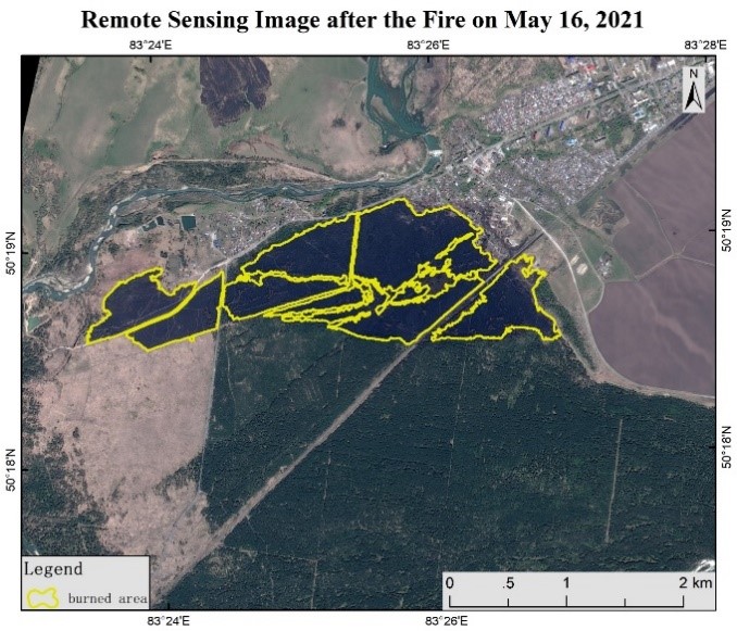
- We analyzed the forest fire near the town of Ridder on May 10-11, based on data from remote sensing of the Earth. This satellite image is provided by our partner, the Institute of Aerospace Research of the Chinese Academy of Sciences. Remote sensing data were obtained in three stages: on May 9, 2021 - before the fire, on May 15-16 after the fire. Due to the fact that the monitoring area was cloudy from May 10 to 14, the data was not available, - said Deputy Director General of the Cluster of Engineering and High Technologies Omirzhan Taukebayev.
Figure 1 shows the pictures of May 9 and 15 before and after the fire. Specialists of the center explained that the yellow part of the picture is the burned area. Its total area is 242 hectares. Picture 2 was taken on May 16. It is synthesized with a conventional color. The red area in this picture is the vegetation area, and the burnt area is black.
So what other opportunities does space technology have in the event of an emergency? In search of an answer to this question, we asked Bakhyt Sakhariev, director of the Center for Remote Sensing at our university. According to him, the data obtained from satellites are very convenient for the analysis of large areas.
- Data from remote sensing satellites are useful for analyzing the consequences of emergencies, technical disasters and climate cataclysms. In addition, it is faster than ground or air surveillance methods. ERS is an indispensable method, especially for the analysis of areas with an area of more than 10-100 square kilometers. It is cheap and safe, - says the head of the center.
(Figure 2. An image synthesized with a conventional color)
Currently, remote sensing technology shows that it is possible to monitor even high-risk areas. The analysis takes into account the distance from the forest to the rugged terrain, roads and settlements. Another important factor influencing the speed and direction of fire is the composition of wind and forest vegetation. This is because dry, diseased trees can burn quickly and pose a threat to engineering structures even in windless weather.
ERS data is also used to map fire-prone areas and compare with the frequency of forest fires in previous years. In this way, it is possible to find areas with high and low risk of fire and develop a rational strategy for disaster management.
Extensive analysis is performed based on ERS data of high and medium spatial accuracy. For example, a detailed analysis of the spread of fire; determination of the area of the burned area and assessment of the economic damage; planning of preventive measures to eliminate fires; identification of deep combustion centers of peat.
Sardoba put in the yellow
In addition to forest and steppe fires, one of the most frequent emergencies is flooding. A year ago, an accident at the Sardoba Reservoir in Uzbekistan caused a stir on both sides. At that time, scientists of our university on the basis of space imagery quickly and accurately identified the affected areas in Maktaaral district of Turkestan region.
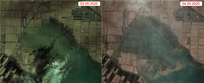
According to experts, the total area of flooded areas in the two countries was 60 thousand hectares. Including 15.2 thousand hectares of land belonging to Kazakhstan. During the filming, experts found that 24 settlements of the two countries were located in the disaster zone. Seven of them are located in our country. Depending on the terrain, the water flowed slowly. The relief analysis showed that the region in Kazakhstan is located on a slope. That is why a large amount of water immediately reached our settlements and fields. After the dam burst, most of the water was concentrated in the lowlands on the border between Kazakhstan and Uzbekistan, creating a large flood zone at a sufficient depth. As shown in the satellite images taken on May 3-4, 2020, the boundaries of the flooded areas have expanded. This can be explained not only by the slope of the terrain, but also by the lack of natural barriers to flooding and large drainage channels.
Specialists of the center also assessed the post-disaster condition of the Sardoba reservoir. As a result, after the dam burst, the surface area of the reservoir decreased by 24.1 square kilometers. In short, an emergency can occur in any area of our lives. One way to respond quickly to such threats is to learn new ways of processing data.
Camilla Duisen